5.10.2008

Kind Of Last Minute

I'm going to head out tomorrow for some low-key adventure ... unless tMail insists on something insane. I have no thoughts on the matter at this point and simply will look back to past posts for Summit Dog
ideas. The biggest problem with tomorrow is that the sun will be shining and the weather will be fantastic. Is that okay? Maybe doing a shortish hike with a 40lb pack... hmmm, although my achilles tendon on my left leg is going the PuppetMaster route... kind of sore, with soreness leading up almost into my calf.

[Update 5/11/08]
Spanky and I did Lafayette again. We were going to do the Falling Waters loop, but I was concerned that there might still be debris coming off the cliffs after the incident last week where that poor woman got killed by a falling rock.

At the summit today, I chatted with a caretaker from Greenleaf Hut who was the first one on the scene. The woman's husband and a friend were there and it was almost two hours before this guy got there (the time it took some other hikers to descend, call the police/rescue, etc.). She had very serious injuries and died before she was off the mountain.

The hikers were on the trail where it narrows under the cliffs while crossing and ascending the steep sides. He tried to describe the exact spot, but it was tough to figure out exactly where. The next time I'm on it I'll look for the spot where "the trail dips down a little and rises up out of a sort of dip - they were in that 'bowl'"

Apparently the hikers heard the rocks start falling and all of them tucked in and tried to protect their heads. She got hit by a rock that was about three feet across at its largest dimension and nothing would have saved her. She had massive injuries to her spine & head.

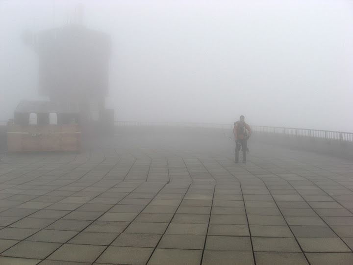
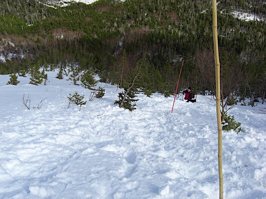
Summit Dog Pics (only four) here. Stats: 3,600ft, 4mi, 1:25 (avg 21.25 minute pace). This was a difficult bareboot due to the challenging monorail that is still well-formed at higher elevations. We spent almost 1/2hr on the summit having lunch and chatting with the caretaker about the accident. The entire trip was about 3.5 hrs (taking a little longer on the descent). This does, however, set the bar for an up-and-down this summer: sub-three hours. I believe today saw the last posthole of my 2007/2008 winter season (two postholes today, to be exact).

5.03.2008

The Descendants of Noah

Observation Deck

Our great ancestor Granpa Noah once said: "Crap, will you look at all that rain!". Our brother tMail said: "It's fucking water. Who cares. I drink water and then piss it out."

Sunday, May 4, 8:30am, Irving Station at Fabyan Junction, NH across from Bretton Woods ski area. Up Jewell, to Gulfside to Alpine Garden (tapping Nelson Crag?) and then summiting via the eastern snowfields if we can see what we're doing.

At least Noah had a boat.

[Update 4/4 11pm] Pictures Are Online: tMail's here, mutha's here.

[Update 4/5 7am]:

tMail's Trip Report:

My trip reports starts Saturday...missed call from MadDog but I have a voice..."Tmail, whats up! Wanted to know what is going on tomorrow, I don't mind getting a little wet, I would really like to get out"

Think the cash register sound...Cha Ching...I call Mutha..."Hello Dan there" its Sue..."He is outside setting Vermont on fire hold on"...Mutha gets on the phone...TMAIL..."Mutha...MadDog called he wants to go hiking" Mutha says..."aaaaaa ok"...Tmail..."mutha listen going to be wet but we need to get out there test the gear...live the experience...come on we are in it together...Fuck it...we are BAD BOYS!!!!!"

I depart at 5.30am sharp and head North to meet Brother Mutha at the Irving gas station. I pull in and we each put our driver side windows down a mircomillimeter because of pouring rain and words are exchanged like "Hi" "Hi" "Its raining" "drive to trail head"..."ok"

We drive separate cars to trail head get dressed in driving rain...and pay our 5 dollars each...to park, by the way I will get that 5 bucks back at some poing in my life!!!

We hit the Jewell trail in Marmot Precip gear which I admit it keeps you dry...the pants work...and jackets clam bake...but I wore short sleeve shirt underneath and was able to wear the jacket all the way to the summit of Bad Boy. Conversation included...marathons, Gannett, tripping, mosquitos, monorail, cog rail way, guitar hero, snow pack, Great Gulf, dead people, Edgar Allan Poe, Cog Rail again...

Highlights of the trip...

Cog Railway
Getting black lung from the Cog Railway
Some guy standing on summit that rode up on the cog asking us if we were cold while he was shaking to death
A crow that flew 10 feet from my head
The Clay Loop was interesting we need to check out in summer...it reminded me of scenes from the Bible Golgotha and Mt Sinai...it seemed eerie in the fog and it was really really quiet...

Also Mutha didn't want to admit this but we baptized him with a piece of coal and mountain snow melt water...


Mutha's Trip Report:
At the Irving gas station the winds were high and the rain steady, suggesting a day to really test the rain gear. By the time we actually started out on the trail the rain was light and that was pretty much the end of it. After a clothing change at the summit we were so warm that on Clay we stripped down to base layers. Also on the summit: we found the winter-hiker summit sign-in book. It's in the alcove/entry to the Visitor Center where we often change out of the wind, just to the left of the door, mounted on the wall. It's funny I've never noticed it before.

I'd just like to go on record on this blog for making the following statement which, if we're lucky, will get googled somewhere, somehow: The Mount Washington Cog Railway is the biggest piece of shit abomination against nature and the peaceful, tranquil and pristine qualities of the Mountain. The soot, coal, acidic, sulphurous smoke is disgusting. Any tourist paying their hard-earned wages to that organization is getting ripped off and is supporting an insidious form of eco-terrorism. God Damn The Cog Railway.

Aside from the cloud of cog railway soot, the conditions were near perfect. Visibility was about 50yds and things were really calm and quiet. The following exchange on the descent from the summit was a class tMail/mutha. We were on the Jewell trail at the trail junction with the Clay Loop trail which (so you don't have to get out your maps) heads north out over Clay and meets up with the Gulfside trail, which we could then take back to Jewell, intersecting it a bit lower than where we were currently standing:

tmail: what do you want to do?
mutha: uh... [looks at watch] ... well, it's about 2pm, so i don't really care about doing Clay.
tmail: yeh, uhhhh
[we stare into the fog]
mutha: bascially, i'll follow if you want to do Clay, but if I were alone I'd just head down now.
tmail: yeh, fuck Clay.
[we stare into the fog]
mutha: you know what we could do?
tmail: what?
mutha: we could go out a bit and check out what's going on and then just come back the same way... which could be kind of dumb...
tmail: let's do it.
[not only did we head out over Clay, but we did the whole loop. it was worth it]

4.28.2008

Next Outing: Sunday, May 4th

As a follow up to some email exchanged (and tMail's comment on the previous post), this Sunday should be great weather on the heels of three days of cold rain. Suggested hikes can include distance, weighted packs or both. I don't think we need to dive right into long-distance weighted packs, especially in the deep mud - but maybe that's just me and my sandy diaper.

Some ideas- a few of which should be left for drier conditions after memorial day:

  • The Kilkenny Ridge to tap both Cabot and Waumbek on tMail's list.
  • The Kinsman Ridge from Kinsman Notch to Franconia Notch, hitting Wolf Mtn, S & N Kinsman, the Cannon Balls and Cannon.
  • Kinsman Ridge round trip starting from Kinsman Notch (Tap North Kinsman and return).
  • Isolation loop starting on the Rocky Branch (after memorial day)
  • Isolation w/ car spotted (Isolation Trail or Glen Boulder to Davis Path)
  • Nancy Pond Tr to Stillwater Junction to Thoreau Falls Tr to Ethan Pond (requires spotting a car).
  • Signal Ridge Tr. to Carrigain to Desolation to Wilderness to Thoreau Falls Tr. to AT.
  • Hale Brook to Lend-a-Hand to Zealand, return via Zeacliff and Zealand Road.
  • Webster Scout to Adams to Jefferson to Six Husbands to Great Gulf.
  • A Pemi loop, skipping N. Twin and Galehead but tapping West Bond (I vote for a late June Pemi).
I'm pretty sure these are all over 15 miles and all have significant elevation gain. Most require spotting a car, however all can be turned into loops. This (and any others you can think of) will be a good master list for long day-hikes in prep for Jay/Gannett.

[Update 4/30] tMail has called it: He'll be running up the Jewell Trail, circling Mt. Clay a few times and then running up and over the Bad Boy, doing a few pushups and then waiting a few hours for me to catch up. Damn you, tMail!

4.22.2008

Saturday On Dodge's

In spite of the crowds, I was thinking of heading up Dodge's on Saturday. It would be a leisurely stroll up to Tuckerman's, a climb up Dodge's and a descent down Boott Spur to avoid the horrible Lion's Head trail. If anyone is interested, post a comment.

[Update 4/26]: Bah, I bagged it. I'm getting my bikes out, cleaned up and my water bottles washed - getting some gardening done. I haven't been on a bike since last September. Maybe Dodge's tomorrow... or not until next spring... If not, today will be the official day that all the winter gear gets put away.

[Update 4/27]: Bah, I bagged it again. I woke up to cold rain - not inspiring for hiking. It looks like a day destined for database application programming.

4.20.2008

Lafayette

The brooks are running high and the trail Monorail Pic
is still snowy in the trees - but falling apart in spots. the monorail varies from two-snowshoes wide, to a few inches (see pics here). Postholing is pretty rough off the trail, and a few spots of the trail itself where it's undermined by meltwater are collapsing, leading to some startling drops.

"Monorail" is my new term for this thing. I got the word from somewhere - I think VFTT.

Above treeline, the only snow is the little snowfield just shy of the summit, and little patches in protected spots.

Spanky had her first 4,000 footer (5,260') and was damned tired on the way home. She slept for the entire ride, only waking up when I pulled in the driveway.
Summit Mutt

I was expected hundreds of hikers today. There was one other guy going up, and on the way down I met 3 people. That was it. I have no idea why there weren't crowds on a picture-perfect day, one of the last snowy hikes of the season.

Pics are posted here (Picasa slideshow - no audio).

4.19.2008

Another Last-Minute Trip

In the wind-up to Monday's marathon, nothing is going on.... not really. The runners are pacing nervously like horses at the starting gates; the PM is soaking his bum tendon in hot (or is it cold?) water; MD is in hiding, replacing most of his body parts with titanium replicas; g-$$$ is ... is ... where the hell is g-$$$?

Anyway, the forecast for this part of the world is for hard blue skies, light breezes (if any) and warm sun. I may head into the hills on Sunday in case anyone is looking to kill some late spring, pre-mud, tronching around. Let me know if you're interested, otherwise I may join the crowds in some of the more popular spots "Ohhh, yeeeaaahhh, baaaabeeeee, that's skiiiin' ma man!" (MadDog and I actually heard that on Hillman's).

4.17.2008

Today was one for the Record Books

Mad Adventures of MadDog and Mutha: WE TAPPED THAT. "Tapped" What? Great question. Hillman's Highway. No kidding.

We had bright blue skies - not a cloud to be seen anywere. Winds may have gusted as high as 3mph but I doubt we experienced anything that tremendous. Temperatures in the parking lot at Pinkham were probably 50°F at 9am and at the summit they reached about 40-45°F by midday, maybe higher, so above Tucks we were probably hiking in 50°F still air.

We decided not to summit, but instead play around at the top of all the ravines, watching skiers and just generally enjoying a terrific day out. We chatted with the folks at the top of Left Gully, which I have to say is pretty darned steep. Pics are posted.

Mutha's Report:

At Pinkham, MD notes that forgot his crampons. The First Fatality
New plan: still do the Hillman's/Lion's Head loop, but MD can use my crampons.

At Pinkham, MD notes that he forgot his sunglasses. New plan: MD borrows my sunglasses, but then breaks them in the prep room. New New plan: MD and I go upstairs and buy new sunglasses in the shop.

The ascent up Hillman's was most memorable because wearing crampons caused MD pain in the knee when he kicked in. The solution? BAREBOOT HILLMAN'S! (That's why they call him Mad Dog!)

I chose a route at the top MD Tops The Pucker
that included a great pucker-licious climb over a hump in the outcrops. It was steep enough that you couldn't see over it when looking back down. The photo at the right is Mad Dog topping out over the pucker. I had to enlarge his image. To appreciate this, click on the pic to zoom, and appreciate that Mad Dog has 1,500ft of open valley down to the cabin.

The avi runout at the bottom of Hillman's is impressive. Pics to follow tonight.

Lion's Head Descent: Human ping-pong. MadDog will confirm: above Heather's, it was unrecognizable.
MadDog's Report:
Another custom designed delight for all the senses (including non) by Mutha. And pucker-up I did. The "yeeeaaaah Baby" crowd was out in force. At one point the waterboy who joined us says to me, "hey, that guy is incredible!" So I am forced to leave my own little drama on the last pitch, and I look up to see Mutha sprinting on a near vertical face. Oh yeah, I said, that's MUTHA, he's a MONSTA. Then 2 mins later I realize that the above-mentioned sprinter was supposed to be cutting me steps - on the steepest section. So what do I find, nothing but two little entries from his front points. Bastid!


Yes, throwing stuff into a bag on couple of sleep can lead to interesting times at the trail head. But why tap? Let me just say this...half way up the highway, MZ and MD are engaged in deep conversation of vernaculars - the context was in academic settings. Somehow, the conversation drifted (i.e., sunk) to tap. Now, you might be shocked to learn this but Mutha's voice is like his legs, it has the ability to travel great distances - with ease. So no sound suppression was in place for the tap conversation. Later on the climber Waterboy (Mutha can explain him) joins us. And as we take a rest on the climb, I'm looking for some empirical data on the tap topic, from Waterboy. So I put the question to him about it's use, popularity, longevity, etc. To which he replies two things. First, it was something he used to say when he was in the 8th grade - rut roh. Second, there's no need to give him background on the conversation that led to it all, because (thanks to Mutha's ability to project his voice), every climber and skier in Tucks heard the conversation. I laughed so hard I nearly came out of me steps and went sailing down the highway. You just can't make this shit up!

4.11.2008

Slow Friday Afternoon

Man, nothing but rain in the forecast. The Danville snowpack is coming apart at the seams, especially in the fields. Huge brown patches of meadow are growing rapidly every day. In the woods, ice and snow are still thick - 2-3ft almost everywhere. But the crocuses are up on one side of the driveway (alongside the house) even though the snowbanks on the opposite side are as much as 6ft thick in the shade.

Maybe Sunday the weather will cooperate. Otherwise, I think I'll clean out the garage.

Dang.

4.06.2008

Sunday Adventure

I did the Hillman's/Summit/Lion's Head loop today. Rather than bore you to tears with obvious details, here are some highlights:

  • As you know, there is an incredible amount of snow on the mountain. Hillman's is so filled it that it's like a straight bowling lane.
  • The entire ascent was scored with the sound of sleet-like ice running down the gully like sand down a dune.
  • Significant clouds, forming undercast (see Picasa Album). Treeline on Lion's Head
  • The real big excitement: Lion's Head Trail was so filled in with snow it was almost unrecognizeable. The pic to the right is looking down on a guy ascending. I'm standing at the spot where we normally change just before treeline. No shit. That means that where I was standing had to be on top of at least 10-15ft of snow. (g-$$$, the trees down the slope behind the guy in the picture are about where you and Higgins were working on his boot issue when I met up with you guys last Feb.) Heather's wasn't any steeper than anything else. Everything was this horrifically steep pile of snow all the way to the woods just before the trail meets the access road.
  • I had a nearly continuous, high speed, high excitement butt slide all the way from the 'breather rocks' below Lion's head all the way down. It was pretty controlled and I stopped frequently to check my speed. I only lost control once, but I can tell you that the guy that shot into the woods last month (and had to be rescued) almost had a buddy in the ICU. I tried to stop by jamming into a tree trunk but was moving so fast I went into a spin of sorts. I couldn't get my axe to bite hard enough and stopped by hitting my leg against a trunk and grabbing a branch.

4.02.2008

Next Saturday, 4/5: The Massing Hordes

Rumor has it that if all wannabes show up for hiking fun it could be the largest group assembled legally in the state of NH in over 200 years. It may just boil down to one or two in the final analysis, but the current tentative list is: me, the PM, tMail, g-$$$, MD, treadmill, bobW, nateG, nateG's mom, my uncle Walter, the Concord (NH) Men's Chorus and all of Stephensville, Newfoundland.

Remaining on tMail's list (I think I have this right):

  • The Bonds (one trip, but not this spring)
  • Cabot & Waumbek (two trips this time of year - one if done as a warmup to Jay in June/early July)
  • Isolation (the only one on this list I'd be interested in for saturday - but not via the Rocky Branch which could be hugely challenging with high water)
Other possibilities, all weather dependent of course:
  • Chocorua
  • Hillman's
  • Other
Right now things are melting rapidly at lower elevations (in spite of the bitter cold that overran us last night). I think we should anticipate spring conditions at brook crossings. Bob and I saw snowbanks three or four feet thick on Falling Waters (with some snow bridges between two and three feet thick) - but it was clear this was going to be rapidly changing and we actually made it a point not to step on what seemed to be the weakest spots, in spite of the thick ice.

Lastly, do NOT consider going out Sunday to Hillman's or Huntington or whatever without sharpening your crampons. Bob and I hit some really, really hard ice on the 'Bone and with the heavy rain and bitter winds we just got, things are going to be icy everywhere (crusty in the woods).