5.29.2008

Those Busy Little Beavers

The Great Dam
I finally remembered to take a camera along while exploring some beaver dams and meadows (marshes) on the east end of the Great Mysterious Danville Zone of Deadly & Disorienting Marshland, Coniferous and Deciduous Forest. These pics cover a run/hike that took 1:55 total trip time. I didn't get a shot of it, but I saw my first Danville bald eagle (from about 50m). It flew off when we came out of the trees and splashed in the mud.

The video below is of following a beaver road to the edge of the Active Dam. Note that I have to stoop pretty low to follow the dogs.

5.26.2008

Isolation Trip Report

As tMail and MadDog get their trip reports to me in the comments, I'll post them here in the body. I just want to say this: Have you ever seen anyone run up Boott Spur? The Three Yahoos
Have you ever seen anyone run down Boott Spur? Even if you have, have you ever seen anyone run up and down Boott Spur? I have: tMail. The man is a machine. It was like watching to approaching cold front. Nowhere to run, nowhere to hide. Mutha's pics are posted here (slideshow) and tMail's here.

Mutha's Trip Report:

The route was Boott Spur to Isolation via the Davis Path, and back the same way. The conversation covered everything from the price of gas to beaver dams to Obama to the ethics of giving water to strangers on the trail. Even the ride home was nonstop (mostly me) chattering. I have nothing more to say to anyone, ever. I'm completely tapped out.

So as I was saying... our feet were soaked from early on, with frequent postholes down to cold slush and lots of mud and running water. We eventually stopped trying to avoid the soaking and just walked through ankle-deep water instead of rock-hopping.

It was a terrific day (I think MD was down to a little over a dozen Ibuprofen - a record!).
tMail's Trip Report: Things Learned - Things Witnessed
MadDog eats these little pills which makes him bounce off rocks
Muthaz will kill anyone in West Virgina
Muthaz will kill anyone that litters in the Whites
MadDog said something to me like Mush or go Tmail or Tmail this looks "trottable"
MadDog is to blame for everything, his words of wisdom "it just depends on how much pain you can take"
Muthaz will run for President at some point in his life and his VP will be a Sardine
I saw my first pregnant person on Boott Spur
MadDog carries a big shaft
MZ is a camel needs one drop of water for 7.5 hours of hiking
MadDog loves rail bed...
There are three summits for Isolation I stood on one of them does that mean I have to go back?
If anyone needs water in the Whites don't ask me unless you are on the following list:
- Muthaz
- G-$$$
- MPM
- Tmill
- MadDog
- Spanky
- Riley

MadDog's Trip Report: A few things for the pseudo-national archives
1. Given any opportunity to reveal his underwear, Tmail will do so.
2. Never utter the phrase "This looks trottable." within earshot of Tmail.
3. If someone should intentionally toss wrappings/personal trash onto the trail, Mutha must never come to know their identify. It could be fatal (for them).
4. The national weather service appeared to spot on with their detailed forecast of the day (except for rumblings and thunder). Which is OK, there was an ample supply of flatulence.
5. What is it with cinnamon raisin peanut butter?
6. What is it with sardines?
7. Dodges appears to be a class I-II pucker. I may have sinus infection the day that winter trip is done.
8. Tmail, chuckled and commented upon entry into the Prius stone-mobile, saying how was not not-so-clean. Little did he know, but I had just cleaned it for this trip, removing dust, saws, chisels, and granite pieces. Apparently there are different benchmarks - a stonemasons and Tmails :-)

5.25.2008

Memorial Day Route Plan

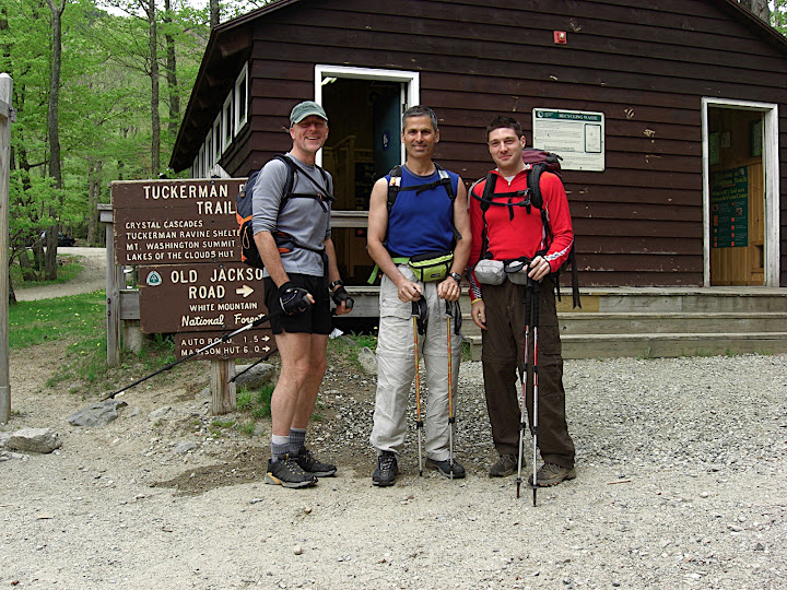
The topic was started here, but The Hump story broke the continuity. Damn hump.

I'm still not sure of tMail's preferred route. He mentioned ascending Boott Spur from PNVC and returning to PNVC via the "Direttissima". Here are the two routes being discussed, along with some discussion:

  1. Glen Boulder west to Davis Path. Davis Path south to Isolation. Return the same way or possibly continue on the Davis Path on the way back an additional 0.5 miles north to the summit of Boott Spur, descend via the Boott Spur trail to PNVC. Approx. mileage: 13.2 regardless of return route (Glen Boulder vs. Boott Sput).
  2. Glen Boulder Trail to Davis Path. Davis Path south to Isolation. Return only 0.9 miles on Davis Path but then make a right (East) and return to rte 16 via the Rocky Branch trail. Approx. mileage: 13.2.
Rte #1: If we thinks this is likely, we'd want to park at PNVC and take the "Direttissima" trail to Glen Boulder to leave our options open. Returning on either route would put us back at the PNVC. Disadvantage: requires second ascent of Boott Spur. This means that the final stages of the hike are exposed and at high elevation. Advantage: great views of approaching cold front.

Rte #2: This requires we spot a car at the Rocky Branch trailhead on the way up to PNVC, about 4 miles before the visitor center. Because we'll probably have two vehicles on the way up rte 16, this won't be a major inconvenience because we'll pass the Glen Boulder trailhead on the way to the PNVC. Advantage: entire final return is protected. Disadvantage: it's possible that much of the protected trail is on snow monorail and we'd have to spot a car.

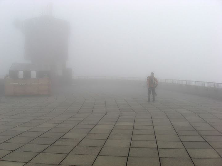
Weather: The current forecast for Memorial Day is for nice weather to start, though windy. As the day progresses, the cold front will move rapidly through, bringing high, gusty winds, lowering cloud-deck, fog, and increasing probability of downpours, lightening, etc., although the precipitation may be more of an 'evening' rather than 'afternoon' threat. At this point I'd take the conservative approach and suggest that if we are above treeline after 3pm we should count on issues of cold/wet conditions. This could easily over-estimate the arrival time by 3 or more hours, but I'm okay with that.

Conditions: I expect a significant monorail in the forested sections of the Davis Path as we descend into Oakes Gulf. There may be sections of Glen Boulder w/ snow but I seem to remember it being pretty open up high - not sure. MadDog, based on our experience last week, I'm inclined to wear long nylong pants and gaiters w/ leather boots.

Time: This is a hard call. MadDog and I did 16.1 miles last weekend in about 7 hours. While conditions were challenging (to say the least) at high elevation, we ran/trotted for much of the AT, averaging over 4mph. When I did Isolation via Glen Boulder (hitting Monroe on a side-trip on the way back) in 2006 it took about 8 hours. I think it's fair to say tomorrow's jaunt will run about 7 hours.

5.24.2008

In The Meantime: The Hump

Great day for a hike. The bugs were swarming and biting in the parking lot, The Motley Crew
but the summit was cool and refreshing. The PM and I wore heavy packs, treadly wore sneakers and a pack weighing over 3 lbs. Uncle Pete came in somewhere in between.

Riley and Spanky met, fell in love, but parted friends.

Highlight of the hike: Strange man stopping us to hiss "I have lost my sense of tiiiimmme...". I think he was from Mars. Also, the PM gave me an interesting article on a rogue physicist.

Pics Are Located Here

5.19.2008

Memorial Day!

I'll leave this a bare-bones post for now. tMail, what was it you wanted to do? Isolation the hard way? Post your suggestions in the comments and I'll paste them here and edit this post as we go. Any comments on MadDog's beaver can go to the previous (Willey Range) post.

5.18.2008

Willey Range Trail to Ethan Pond

Mutha's Trip Report:

Oh man, what a day. Excellent weather and light packs in shorts and trail-runners ... on up to SIX FEET of snow. We were slipping, MD's Knee on the A-Z
sliding and postholing all day, dropping into mud, water and slush. We had cold wet feet all day, and that goddamned A-Z trails was nearly unnavigable - just snow, mud and running water.

The weather was perfect, however, even if it was a little cold on the ridge. Conditions on Ethan Pond were very fun. We made great time at a run and MadDog, in his typical MadDogish way, came out of retirement from the Hut234 to hammer out the miles (around 16.5) for 7 hours of grueling, wet-footed sloppiness.

Highlight of the day: watching a Pine Marten watching us. See pics. Pics are located here.

MadDog's Trip Report:
Humane Society Search

Where are they when you need them? I traveled with the MZ minstrel today. Really my first rock hop outing, where I could hop vs hobble since pre-Hut2hut. Well, I paid for it.

We had a great start, chatting, exchanging ideas and general chit chat at a comfy/hurried pace. I was panting early. Then like a switch had been pulled, as soon as we hit elevation, MZ bolts aways and runs the hills. It was then that I knew this was a going to be a long day for this puppy.

The routes were coated with "monorails", footing for very large sections was really bad, lots of slips, falls, banging trees, weird looks from other hikers, postholing hip deep like there was no tomorrow. Adding to that crap, during one of 14 or so, crashes, I managed to smash THE other knee & get the legs bruised, pierced and scratched like I was mauled by a catamount. Then, sprinkle in some dehydration, tanking 3/4 way out, leg cramping and pounding headaches from sucking wind all day. Ah yes, overall, some good ol' fashioned fun on the MZ pain train. I'm done, it's bed time.

5.13.2008

Next Sunday: A hurried pace for Jay

I have an interest in doing some longer distances at a hurried pace. I think this coming Sunday (5/18) I will probably be heading out to Crawford Notch to do the following loop:

  • Park at Crawford Depot (little bldg south of AMC Highland Lodge)
  • Avalon Trail over Mt. Avalon
  • Willey Range Trail to AT
  • AT to Zealand Hut
  • A-Z Trail back to car.
By 'hurried pace' I mean actually running where possible, trotting where I can't run, hurrying where I can't trot and walking while gasping for air where I can't hurry. I plan on bringing only 2L of water and food, which may make the Willey Range section Crush, Kill, Destroy!
sketchy if it's cold/rainy - so maybe a second top/shell. Footwear: trail runners ... or maybe mid-weight leathers... not sure now.
  • Approx Distance: 16.3 mi.
  • Max allowable time: 6:00 (otherwise be stomped to death by the PuppetMaster - see illustration at right)
  • Estimated time: 5:30
  • Goal time: sub-5h
Realistic? No idea. The time does include stopping for more water at Zealand Hut (if need be) and stopping for a snack or two, although in general the plan would be to not really come to a stop at all.

5.10.2008

Kind Of Last Minute

I'm going to head out tomorrow for some low-key adventure ... unless tMail insists on something insane. I have no thoughts on the matter at this point and simply will look back to past posts for Summit Dog
ideas. The biggest problem with tomorrow is that the sun will be shining and the weather will be fantastic. Is that okay? Maybe doing a shortish hike with a 40lb pack... hmmm, although my achilles tendon on my left leg is going the PuppetMaster route... kind of sore, with soreness leading up almost into my calf.

[Update 5/11/08]
Spanky and I did Lafayette again. We were going to do the Falling Waters loop, but I was concerned that there might still be debris coming off the cliffs after the incident last week where that poor woman got killed by a falling rock.

At the summit today, I chatted with a caretaker from Greenleaf Hut who was the first one on the scene. The woman's husband and a friend were there and it was almost two hours before this guy got there (the time it took some other hikers to descend, call the police/rescue, etc.). She had very serious injuries and died before she was off the mountain.

The hikers were on the trail where it narrows under the cliffs while crossing and ascending the steep sides. He tried to describe the exact spot, but it was tough to figure out exactly where. The next time I'm on it I'll look for the spot where "the trail dips down a little and rises up out of a sort of dip - they were in that 'bowl'"

Apparently the hikers heard the rocks start falling and all of them tucked in and tried to protect their heads. She got hit by a rock that was about three feet across at its largest dimension and nothing would have saved her. She had massive injuries to her spine & head.

Summit Dog Pics (only four) here. Stats: 3,600ft, 4mi, 1:25 (avg 21.25 minute pace). This was a difficult bareboot due to the challenging monorail that is still well-formed at higher elevations. We spent almost 1/2hr on the summit having lunch and chatting with the caretaker about the accident. The entire trip was about 3.5 hrs (taking a little longer on the descent). This does, however, set the bar for an up-and-down this summer: sub-three hours. I believe today saw the last posthole of my 2007/2008 winter season (two postholes today, to be exact).

5.03.2008

The Descendants of Noah

Observation Deck

Our great ancestor Granpa Noah once said: "Crap, will you look at all that rain!". Our brother tMail said: "It's fucking water. Who cares. I drink water and then piss it out."

Sunday, May 4, 8:30am, Irving Station at Fabyan Junction, NH across from Bretton Woods ski area. Up Jewell, to Gulfside to Alpine Garden (tapping Nelson Crag?) and then summiting via the eastern snowfields if we can see what we're doing.

At least Noah had a boat.

[Update 4/4 11pm] Pictures Are Online: tMail's here, mutha's here.

[Update 4/5 7am]:

tMail's Trip Report:

My trip reports starts Saturday...missed call from MadDog but I have a voice..."Tmail, whats up! Wanted to know what is going on tomorrow, I don't mind getting a little wet, I would really like to get out"

Think the cash register sound...Cha Ching...I call Mutha..."Hello Dan there" its Sue..."He is outside setting Vermont on fire hold on"...Mutha gets on the phone...TMAIL..."Mutha...MadDog called he wants to go hiking" Mutha says..."aaaaaa ok"...Tmail..."mutha listen going to be wet but we need to get out there test the gear...live the experience...come on we are in it together...Fuck it...we are BAD BOYS!!!!!"

I depart at 5.30am sharp and head North to meet Brother Mutha at the Irving gas station. I pull in and we each put our driver side windows down a mircomillimeter because of pouring rain and words are exchanged like "Hi" "Hi" "Its raining" "drive to trail head"..."ok"

We drive separate cars to trail head get dressed in driving rain...and pay our 5 dollars each...to park, by the way I will get that 5 bucks back at some poing in my life!!!

We hit the Jewell trail in Marmot Precip gear which I admit it keeps you dry...the pants work...and jackets clam bake...but I wore short sleeve shirt underneath and was able to wear the jacket all the way to the summit of Bad Boy. Conversation included...marathons, Gannett, tripping, mosquitos, monorail, cog rail way, guitar hero, snow pack, Great Gulf, dead people, Edgar Allan Poe, Cog Rail again...

Highlights of the trip...

Cog Railway
Getting black lung from the Cog Railway
Some guy standing on summit that rode up on the cog asking us if we were cold while he was shaking to death
A crow that flew 10 feet from my head
The Clay Loop was interesting we need to check out in summer...it reminded me of scenes from the Bible Golgotha and Mt Sinai...it seemed eerie in the fog and it was really really quiet...

Also Mutha didn't want to admit this but we baptized him with a piece of coal and mountain snow melt water...


Mutha's Trip Report:
At the Irving gas station the winds were high and the rain steady, suggesting a day to really test the rain gear. By the time we actually started out on the trail the rain was light and that was pretty much the end of it. After a clothing change at the summit we were so warm that on Clay we stripped down to base layers. Also on the summit: we found the winter-hiker summit sign-in book. It's in the alcove/entry to the Visitor Center where we often change out of the wind, just to the left of the door, mounted on the wall. It's funny I've never noticed it before.

I'd just like to go on record on this blog for making the following statement which, if we're lucky, will get googled somewhere, somehow: The Mount Washington Cog Railway is the biggest piece of shit abomination against nature and the peaceful, tranquil and pristine qualities of the Mountain. The soot, coal, acidic, sulphurous smoke is disgusting. Any tourist paying their hard-earned wages to that organization is getting ripped off and is supporting an insidious form of eco-terrorism. God Damn The Cog Railway.

Aside from the cloud of cog railway soot, the conditions were near perfect. Visibility was about 50yds and things were really calm and quiet. The following exchange on the descent from the summit was a class tMail/mutha. We were on the Jewell trail at the trail junction with the Clay Loop trail which (so you don't have to get out your maps) heads north out over Clay and meets up with the Gulfside trail, which we could then take back to Jewell, intersecting it a bit lower than where we were currently standing:

tmail: what do you want to do?
mutha: uh... [looks at watch] ... well, it's about 2pm, so i don't really care about doing Clay.
tmail: yeh, uhhhh
[we stare into the fog]
mutha: bascially, i'll follow if you want to do Clay, but if I were alone I'd just head down now.
tmail: yeh, fuck Clay.
[we stare into the fog]
mutha: you know what we could do?
tmail: what?
mutha: we could go out a bit and check out what's going on and then just come back the same way... which could be kind of dumb...
tmail: let's do it.
[not only did we head out over Clay, but we did the whole loop. it was worth it]