8.31.2009

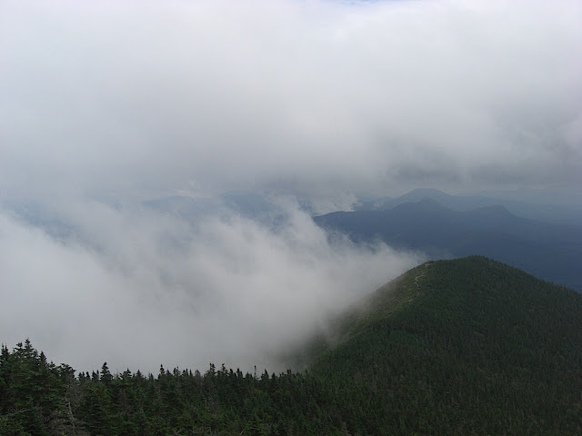
Mt. Mansfield Auto Road: The Race To The Top of Vermont

g-$$$'s Trip Report:

What can I say......thanks for a great race weekend.

Sat night was the best...great food, good times, lots of laughs, and a drink or two to take the edge off of the pre-race stresses.....and it was also confirmation that you are what you eat because I was undoubtedly became a CARCASS this morning around 1020AM. Does that apply to what you drink because then Maddog is an ARROGANT BASTARD and a half......Even so I was so glad to catch up with him and Vicki.

As to the race, thanks to Andy for keeping me company on the warmup and then leaving me to the vultures after the first half mile. Undoubtedly the removal of that bad chain link was the ONLY reason why you beat my by 13 minutes! MuthaZ may have attained Maddog's deity status with his Trifecta of Errors. It used to be only Maddog could plan and execute such workout insanity!!! And PM, thanks for providing your usual pre-race calmness and being a great playbuddy with EZ-E. The entire ride home was a series of questions like: "is the Puppetmaster going to get ice cream with us?", "where does the Puppetmaster live", is the Puppetmaster going to eat dinner with us?" And Anna and Mini-Nate were the ultimate Crew extraordinaire!

As for the race.....I dunno....certainly it was confirmation that I am not in great shape...and definitely not a hill climber anymore. I had serious bouts between self-doubt and self-hatred. There were times when I was sure I was a minute or two from getting off and walking the rest of the way....at one time I was conjuring up any random excuse that could justify my blowing up. That's a metal weakness I've never had before. My goal was to finish under an hour and until I BLEW UP, I was on track to ride around 45 mins, so I was disappointed that I missed out on what I thought was a realistic goal.

Maybe I'll do it again. I still had fun and that always makes a big difference. Lisa commented that it's been a long time since she was at one of my races cheering me on. She said she kind of missed it. So maybe it's time to get some more balance to the daily exercise routines (or lack thereof) and work on a better diet.

But winning that 2 night stay at Commodore Inn from the raffle sure gives me a good reason to come back to Stowe...now do I go back for the race or to go skiing....not the worst of dilemmas to have I suppose but certainly a test to my motivations.

Thanks (to you and your families) for making it a great weekend!!!!


mutha's Trip Report:
it's funny how the mind-demons buzz around like angry hornets on the Bondcliff Trail: the desires (for goal time), the realities and the half-truths/self-doubt/self-hatred. We've all got our demons but yet the challenges we take on are huge. the spectators watch us go by and think "oh wow, these guys are amazing" while in our heads we're saying "i suck, i'm overweight, i suck...".

how funny.

and then the demons are banished by the after-party, the humor and camaraderie of the group, because in the end we all get to lie on the grass, watch evan roll towards the hot, 2-yr old blond at the bottom of the hill and chill and tell war stories.

i can't think of a better life.


the Puppet Master's Trip Report:
I agree, it was a great weekend. For me, to see awesome friends, meet new ones, and see my family, all in the Green Mtn state - it doesn't get any better!

What I saw confirmed -
1) I will always be at least 10 mins behind MuthaZ, athletically and mentally - animal!
2) MuthaZ may have met his athletic match in Andy - animal!
3) Despite self-procalimed melt down and a race not living up to expectations, if I were ever on a bike, I would want G$ there to tow my ass up hill - animal!
4) Had I not sprinted the last 50yds, David Speed would've caught me, pushed me aside and called me his bitch!
5) Racing is 99% mental. I had none of the typical negative thoughts that normally plague me but went out with a bit of a "let's just cruise this thing and keep it steady" attitude. I need to try and find that "let's blast until we melt " race attitude. I finished with plenty of gas left in the engine and I know I shouldn't have.

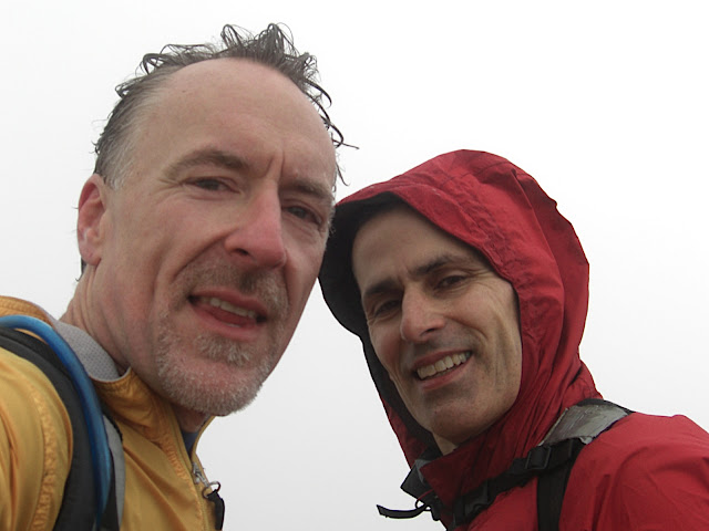
Despite the longest awards ceremony EVER, sticking around for the raffle was worth it. G$ scored a sweet 2 night deal at the Commodore and I got some new shoes and a Catamount Trail book. Andy and MuthaZ, we held your tickets aside and neither won... your glory was on the course!

EZ-E and my nephew wore me out. Between playing with EZ-E at the mountain and then swimming with my nephew after, I am beat! I feel for you guys who have to find the energy to play daily! Great kids are a reflection on great parents.

I look forward to trying this one again next year. Hopefully with my sister by my side.

8.29.2009

2009 Solo Pemi

Trip Report: This is my third pemi, and I have to say that I'm really getting to like them a lot. As MadDog pointed out on our last trek to Carrigain, my familiarity with the route and rhythms means that all that's left is just doing it.

  • Because a sub-12 is a reasonable time, that's a lot less hours on foot than doing it as a hike with a big pack - which can approach 24hrs. That's a long time to be banging out the miles. Shortening it to 12 takes a lot of energy, but my feet and joints don't hurt - just my muscles.
  • The run in on the 4.4 miles to the Bondcliff Trail junction takes less than an hour and is very pleasant. Once you enter the Pemi the trail is narrow, scenic and fast. In the early morning, even if headlamps are used, the woods are quiet, the noise of the river is always present and if the timing is right, the birds are waking and singing.
  • It's not until South Twin that the pace slows. The descent to the hut is steep and slow and because of footing, it stays slow until after Garfield. It can be frustrating because the pace is really just a hike - almost the entire section from S. Twin to Lafayette. There are some brief runnable sections, but you have to treat it as a hike to a large degree.
  • Garfield and the Garfield Ridge trail were always a 'most hated' section for me. Garfield hides Lafayette and looms so large from Galehead Hut that my first time I thought it WAS Lafayette. It's approached with multiple steep ascents, none of which (except the last) are really the final ascent. This time, I was ready for it and the summit wasn't that hard to get to.
  • Garfield has some other problems: From S. Twin, it's probably a 1500' loss of elevation. You have to climb nearly 1000' back up to Garfield, then drop almost 1000', then climb back up nearly 1500' to Lafayette. That's a tremendous amount of elevation lost and gained. I haven't added it carefully, but it looks like roughly 2200' lost and 2400' gained. That section right there is what most hikers would do on a typical day hike. And it falls RIGHT IN THE MIDDLE of the Pemi. That, and the fact that the trail is so slow is what makes that section such a bitch.
  • Oh yeah, and don't forget that the ascent to Garfield near the top is up a brook where you have to climb on the wet rocks. And the descent is on the bare, wet, tilted slabs.
  • Lafayette's false summits are annoying, but being mentally prepared is huge. The Skookumchuck trail hits the ridge just below the summit (in terms of elevation), but there are still 0.8 miles to go. The junction of those two trails is almost surprising because of how high up it is - but you're not there yet. My first time I thought I was within 5 minutes of the summit and was in complete disbelief when I saw "Summit - 0.8 miles".
  • The descent from Haystack, Liberty & Flume all have very steep sections initially. If you're pressed for time, be prepared to have to go real slow in those sections. The surface coming down from Flume is gravel, sand and loose rock. Also, after a long section on Osseo that is runnable, the trail turns into a set of well-built (but slow) stairs. After some slow footing below those, it opens up quite a bit.
  • There are only two sections that are runnable (as compared to trotting or just moving quickly): From the Lincoln Woods Campground to the Bondcliff Trail junction (4.4 mi) and the last 4-ish miles of the Osseo/Lincoln Woods back to the parking lot. If you want to make good time, you have to run those at like an 8.5 min pace or better. There are some sections of the Osseo above the stairs that have to be run as well. Everywhere else it's just a weird combination of hurrying and hiking with a little trot now and then.
  • Be prepared for a difficult ending. Running the Osseo is easy in terms of footing - but it's at the very end of a grueling day. You may have blisters, sore muscles, sharp pains in the knees and/or hips, dehydration, cramping, etc. but you've got to hammer and hammer hard for time. Luckily, it's all downhill but don't forget that the last 1.5 miles is almost perfectly flat. Even though it'll only take you 12-15 minutes, it's an eternity with aches and pains.
  • Water: I started well hydrated and only consumed about 0.75L by Galehead Hut. I drank deeply at the hut and then filled my 2L reservoir. I finished that off ascending the Osseo and decided that it was really cutting it close because I still had a good 40 minutes of hard running w/ no water.
  • Food: I consumed 2 gel flasks of Perpetuem (w/ some gel mixed in and water to make a paste), two clementines (a great idea), a bottle of Boost, a small handful of homemade trail mix including raw oatmeal and peanuts, 12 e-caps.

8.27.2009

Colvin, Blake, Nippletop and Dial

tMail's Trip Report:

Writing this from the grandstand at Saratoga watching the horses work:

We start off with temps around 42 degrees I had liner gloves, HH top and beanie.

The approach to our first two peaks Colvin and Blake was gradual. Beautiful gradual smooth trails. The interesting thing is that Blake was and out and back to so we had to go over Blake twice. The saddle between Colvim and Blake was thick with mud, wet and rough trail. I had trouble in some spots had to go down on ass or backwards. Once off that small ridge we headed down for the approach up Nippletop which was great steady easy climb I pushed a little and felt awesome. Nippletop has some of the best views in the Adirondacks. You can see the Great Range and a majority of all the high peaks. Once off Nippletop to Dial is some of the best trail running one could find. I held back but we pushed. Dial had great views similiar to Nippletop. Then we hit Bear Mountain Den cool little mountain and descended back to trail head. 9 hour day 5 peaks I have no looked at map but between 15-17 miles I think.

Visibility was 100+ miles, conditions were awesome not many people, no bugs and lots of trail time.

For those keeping track knee felt awesome, feels totally normal today can't descend as fast as before but will come with time.

Looking forward to Green Mountain Day!

8.25.2009

No-Man's Land

Mutha's Report (pics are here):

The PM and I started off on the official route of the Gordon Pond Trail (GPT) from Rte 112 (directions found in The Guide). Within a mile or so we departed the 'main' trail and headed up an old 4-wheeler road through a sugarbush that, from the thousands of meters of tubing and the 3 huge polyethylene tanks (maybe 200 gallons each?) indicates ongoing sugaring operations.

From this point on our bushwack was done entirely by compass - of which we only had one, strapped firmly to the PM's wrist. For a bit I tried leading but it was somewhat pointless to keep turning back and saying "more leftish?" and such, so the PM charged ahead the entire time. Our plan was to eventually hit the GPT near Gordon Pond - possibly hitting the falls. We maintained a NW-ish bearing through the most extraordinary terrain - amazing for it's ruggedness as well as its varied terrain. We traversed some of the most beautiful woodland marshes, cliffs, deciduous woods (some open with hardwoods that were criss-crossed with well-established game paths) and higher up around 2,500' some dense fir stands that, as we've all experienced, are so dense it seems unlikely that one's weight could break the hold.

We worked our way North and West like champs, but without a detailed knowledge of the area (or GPS) it was difficult to tell exactly where we were. We eventually ended up below the cliffs that Gordon Falls descend, but we had to work our way SW along the base, eventually finding a steep route that zig-zagged up a 'ramp' in a crevice to top out, again, in some beautiful open woods. There were quite a few sections that were downed tree trunks on top of boulders so that the dogs and us were challenged on just how to ascend - it was like climbing up through a game of "pickup sticks" that were dumped ontop of a pile of leggos.

We never saw any wildlife larger than a bird, but for hours there were moose droppings spaced meters apart, an occasional bear dump and as I mentioned, many well-established game routes.

We reached an elevation of about 2800', close enough to that of Mt. Wolf (3478') so that the terrain and trees were recognizable (I've been on Wolf twice) but we were never able to find our way to that summit. I've revised my best guess for our route (see map at right). Note in particular the traverse at the base of the cliffs SSW of the falls. There are two blue question marks on my map that, to be honest, raise the question of just where we hit our max elevation. We were on a set of pretty tall 'humps' and my dotted route is, of course, a complete guess. Our descent was very steep and required that we avoid some cliff-ish outcrops in the woods, doing a lot of holding onto saplings and the like.

Lastly, I have scratches all over my arms and legs. I look like I've been assembled from a kit.

In looking around on the web I found Steve Smith's blog Mountain Wandering and found this entry concerning the very same area from two months ago. Obviously as co-editor of The Guide he knows his way around and clearly he is similarly smitten by the area. I'd also like to point out, after checking out his blog, that this guy still hits the same backcountry spots that we are and seems to be enjoying many of the less well-trampled areas of the pemi, like the Lincoln Brook/Redrock/Hellgate drainage.

For what they're worth, my pictures are posted here. (Ignore the map on picasaweb and reference the map above.)


The Puppet Master's Report (his pics are here):
A great day out with MuthaZ, Spanky, and Riley the Dog. In sum - the road to hell is paved with good intentions, the journey is the destination, it's not about getting there- it's about finiding yoru way, etc! I couldn't help think of these types of cliches as I drove home last night. What a blast.

We wanted Gordon Brook to Kinsman, for a ~17 mile day but opted for a bushwack to middle Earth and got a ~10 mile day of great adventure.

I bet we saw land that even hunters and loggers have not tread! Our mistake, now that I have looked at the map, seems to be we didn't go in far enough on the road to hit Gordon Brook. We got a little impatient and then just decided to take a bearing and go for it... and we got what we asked for!

Highlights -
1) The deep woods syrup plumbing network that was more advanced than the Ben & Jerry's factory
2) Moose poop every other step
3) The diversity of terrain - from hardwoods that were easily navigable to swimming through the most dense soft woods I have ever been in.
4) The number of old trails and logging roads we crossed
5) Beautiful streams and trickles that fooled us into thinking they were Gordon!
6) Realing at the exit of the woods that we hadn't gone that far but had gone up/over/through a lot of terrain!
7) Post-hike soak in the Lost River
8) Melty ginger ice cream in Lincoln

Lessons learned -
1) Know your start point when bushwacking, it'll make your life easier!
2) Don't wear your sunglasses on your hat, the forest will steal them!
3)If bushwacking, pants and boots required, maybe even a tougher top (like a safari shirt)
4) Bring the AMC Guide in the car or, read the trail description beforehand (optional depending on desire for adventure)
5) Keeping a bearing is tough and takes away from the general trail banter
6) In the Whites, you are never really far from civilization. At no point yesterday did I feel panicked or worried that we couldn't get out. It was either West or South to a road. However, I am glad we ultimately chose South because West looked really f-ing tough!!

8.22.2009

Nancy Pond Trail to Carrigain

Trip report coming soon. 18-ish miles, 9-ish hours, 4,700ft of elevation gain (2200 to Nancy Pond, 2500 up the Desolation Trail to Carrigain summit).

Pics are here.

Cryptic MadDog Trail Report:
An Tale of Auditor Detection - Missing Records and People

Unexpectedly the authorities (NH auditors) showed up at the trailhead. They wanted to see the books on NH's 48 and of the signout log from Ward 6 of the Happy House. In the 48 books, they immediately deteced a problem - Carrigain was accounted for but did not have evidence to support it. So, without representation from the PMO, I could not offer reasonable defenses for the holes. The result was a stiff penalty - march around and into the Pemi with a fellow named Mutha. oh boy.

Then comes the missing person from the Happy House. Mr Propho. An odd but interesting fellow of few words and quirky decisions. The man had been missing for 5 days from authorities, and we found him in the heart of the Pemi just as the auditors and authorities were closing in. Good luck Mr Propho!
Mutha's Trail Report:
Crazed loons in the pemi. Boy Scouts in large packs. Miles in, Miles out. But we tapped Stillwater Junction and over the course of the 18 miles found a dozen awesome spots to camp, with plenty of water.

Big discovery: Carrigain has great camping spots, including a few that are built for camping and have huge freshwater well (water is not potable) - just under the summit!!

We chatted it up and partied like rockstars. The temp was perfect for light-to-no clothes. It hardly rained at all until the end. But the best part: the trail around Norcross Pond is so submerged that dry feet are impossible. Suck it up.

[Updated 8/24 with story originally sent as email to 'Mimers']
maddog and i had a great time on saturday. the stream crossings, of which there were many, weren't threateningly difficult but once or twice we had to spend a minute picking a route (just on the Nancy Pond trail where the trail gets steep like Falling Waters and the brook is bouldery, slippery and erratically contoured.

down in the pemi where the brooks lay flat, most of the crossings were made easier by large stones arranged by hikers. it wasn't a dry-foot day (and at the end i just waded across two brooks rather than rock-hop) but in spite of the huge amount of water draining off the mountains from Friday's torrential rains, we had no challenges that were in the slightest bit worrisome. we didn't have to cross the pemi river itself, which was pretty high. the truth was the brook crossings could've been done with entirely dry boots with no gymnastics or daring jumps.

so this guy that maddog nicknamed "prophylactic man" surprised us with a funny perspective on the brooks:

the guy was anywhere from 60-75 years old. no body fat, but pants, boots and a hat, scrubby grey beard, no shirt. when we first encountered him, our impression was that we had come across a guy who either:
a) lived in the pemi off seeds, berries and grubs
b) live a lifestyle that was not (a), but maybe he just disappeared from society for a few months every summer.
c) he was a complete lunatic that had wandered through the woods looking for victims.

he seemed have either very little language skills or just wasn't thrilled at finding other humans in his territory.

we came across him a second time (we had done an out-and-back to Stillwater Junction) but this time he stopped to chat a bit in his weird, slow, halting manner. as it turned out, this was like his first time camping - perhaps he'd spent his entire life as a dentist and finally decided to go into the woods. his pants were absolutely water-proof, which was odd since he clearly knew that going topless was a better choice (he wasn't carrying his shirt - he was out in just the pants). i was comfortable in my lightest running shorts and minimal tanktop. but this guy looked like he was afraid of bugs on his legs. it was truly a weird sight. maybe you had to be there.

anyway, "Propho Man" confided that he was on day 7 of a 12 day visit to the pemi, camping in one spot and taking little hikes around to explore. that was cool. if you look on a map, there are a few great hikes to take from Stillwater Junction:
1 - shoal pond trail to the AT
2 - thoreau falls trail
3 - bondcliff
4 - lincoln brook, etc. (owl's head region)
5 - carrigain notch, desolation trail, nancy pond
etc.

it's an awesome 'hub' camping spot. and every single route out of there requires a stream crossing. now i can't emphasize enough that the streams were high from the previous day/night's downpours, but you could've stayed foot-dry if you were careful without having to call on some x-men skills.

Propho Man, however, in our querying of what he'd been up to for seven days so far appeared to have a really extreme reluctance to cross water - like a cow refusing to cross a grating. it was severe. to every query of ours, like "have you checked out the Shoal Pond Trail?" his reply was the same: "weeelllll....i tried, but was thwarted by a brook". really. he used the word "thwarted" in every single reply. the guy was out in the Pemi for 12 DAYS! and he was TRAPPED in a small area by brooks that were, i'm not kidding, 6 inches deep and flowing casually.

i told him the true story of being in the pemi a number of times and realizing that to cross a brook dry i had to take my shoes off, tie them together, hang them around my neck and then put them on on the other side. he stared down at his boots and after a long pause said "well.... i guess....but i'm kind of reluctant to take my boots off".

8.10.2009

Weekend Plans for 8/15-8/16

The current forecast is for a dry week. Trails on the Semi-Pemi were in excellent condition. Anybody available? tMail, you plotting a return to the Whites?

I'm up for absolutely any hike. MadDog still has to do an epic Osceolas/Tecumseh day, but that might be for later in the fall, given his schedule. I don't mind a low key trek since the following weekend is the pemi, but we also have a bike opportunity. I haven't been on my bike since the double-gap so the phrase "low-key" really needs to be emphasized.

Well, we have all week so for anyone planning on heading out to NH, get that thinking gland pumping (mmmmmm....).


[Update 8/11] tMail is plotting a return.
[Update 8/14] Moosilauke on 8/15.

tMail, Spanky and I did The Moose. Pics are here.

tMail's Trip Report:
Official reunion of Mutha and Tmail.

At the DD in Lincoln I was handed my lightsaber first time I had seen it since April. Looked like it was in good shape.

Next stop trail head, packed as usual there was a wedding going on or going to be one going on.

We hit the Gorge Brook trail on the ascent good conversation it ranged from rabbits to contact lenses and everything inbetween.

On the summit we had a sandwich and watcedh as hords of people approached the summit.

Mutha and I headed due Northeast on the summit and went to play name the summit.

Descent down was cool we talked about everything from the AT to China and everything inbetween. It included health care talk and inflation and the U.S. Greenback.

Conclusion I pay the same for health care as Joe Blow that weights 400+ and is on lipitor at the Insurance company blows a big load for people like me who just keep paying the towards the pool. We get nothing in return except are bent over and told to pay more.

Also the greenback is worth toilet paper. We ran the feds balance sheet and inflation will strike soon. We compared China to AIG they collapse we are screwed and the USA is like BofA - money pit.

Spanky soaked
Mutha soaked
Tmail soaked


8.09.2009

The Semi-Pemi

Finished the Semi-Pemi today. The route is:
- drop car at Hale Brook Trail, jog up road to Zealand Trail
- Zealand to Ethan Pond to Zeacliff to Twinway
- Out to Zealand Mtn. summit, back on Twinway to Zealand Hut.
- Lend-A-Hand Trail to Hale summit, then back to car.

15.6 miles. Don't know the elevation gain yet.
[Update 8/10] Total elevation gain approx. 4,700ft.

Original goal time was 6 hours. Made it in 5:06. I'm calling it 5 hours. It was a good route for a test. Zeacliff is pretty tough but the others are decent. I took a 10 minutes lunch and chatted for a few minutes w/ a caretaker at Zealand Hut. 4:30 is not an unreasonable goal time if I was willing to to push and not chat.

Pics are here.

8.08.2009

Franconia Ridge: The Reckoning

MadDog called yesterday at 8am. "Mutha! I'm on Rte 93 in Concord heading north. Let's go for a hike!". It took me a few minutes to get my crap together and boom! We were headed up Falling Waters - which was heavily swollen with rain/runoff. We hit the ridge at a sprint with thunder rolling from Lafayette and the rain starting to fall heavily. The winds of Thor tried to blow us off the mountain, adding fast-flying hail to scrape our skin raw. We huddled in the storm to pull layers out of our packs and get some protection from the Mountain Spirits who were partying a little too hard.

Mutha's Trip Report:
  • Kids dressed in too little. (Why do girls think hiking up Falling Waters dressed like they're cruising bars is a good idea?)
  • A huge crowd on Little Haystack, huddled in rain gear behind the rocks, cheering as MadDog and I came out of treeline sprinting as the storm hit. We were in light wicking t-shirts, shorts and trail runners and didn't know at that point that the Mountain Spirits were planning on throwing us over the edge.
  • Temperatures plummeted. Our hands went numb, tendons stiffened, fingers became useless. Even by the time we got to Greenleaf Hut and were warmed up we couldn't open a ziplock bag. We had to use our teeth.
  • Between Lincoln and Lafayette we ran into a guy in cotton pants and t-shirt who was soaked and chilled. We checked him for hypothermia. He was okay, but extremely cold and miserable. The conversation was incredibly awesomely hysterical:
    GUY: Is this the way to Lafayette?
    MD: Which way are you heading?
    GUY: Down, the fastest way.
    MD: We're going this way [points]
    MUTHA: The trail drops down here and the next ascent is Lafayette.
    GUY: There's snow up here!
    [the next two lines spoken at the same time]
    MUTHA: ...and...?
    MADDOG: ... right...
    MUTHA [over his shoulder as they take off, leaving Mr. Cold and Suffering]: Yeah, cotton isn't a great idea.

    The guy eventually made it down. We saw him at Greenleaf.
  • The Most Unbelievable Coincidence: On the way down to the hut, hikers were coming up through the mist. They had waiting for the storm to pass at the hut. We hear "MADDOG, MUTHA!". It was Roland and his son Ryan up for some camping and hiking. Awesome. Best of luck today to Ray, JohnnyB, Spungie, etc. on the Wildman.
MadDog's Trip Report:
Greetings boys, from the Canadian maritime provinces. Hope you all have having fun - doing whatever!.

Folks here are quite nice, the terrain is rolling but overall seemingly flat. Not a mountain to be had. I will be back mid-week and looking for my White Mtn time if anyone is around.

Mutha - thanks for indulging me with some Franconia frolic. It was a nice walk, I got the heart rate amped up on the ascent (sorry we fell short of your PB) and chilled our asses off when we were kicked by the mountain gods when they unleashed their version of buckshot. And it really was funny to hear the roar of the hunkered down teenagers as Mutha dashed out from treeline and passed them at the top Haystack. The guy in cotton was unbelievable - and he was preceded on the rigde by a guy in no shirt - WTF! Roland and Ryan, a pleasant and real nice surprise. Makes me yearn for the end of January, now.

Tmail, I tried the ascent without the bra, it was ok - but with the buckshot hitting us at the ridge, it meant I had to pick my way to the hut before I could get to it. And by that point, I really needed it. Fortunately at that point, I was able to counter it with an ample ingestion of NSAIDs coupled with Mutha's banter of south and north Twin. What medicine. The hike closing ended at the parking lot with Mutha, me and a chipmunk - who made out like a bandit with half a pound of my fav dry roasted and salted almonds. There's a warrant out for that varmint!

Can't wait for the Pemi. I'll be ready with a full pack of pain relievers.

-MD

8.03.2009

Pemi Practice: The Semi-Pemi

I'm planning a Pemi practice run, although not on that loop or I'd end up killing myself. If anyone is interested, the loop I'm thinking of is:

  • Start: Park at the Hale Brook Trail trailhead. Head up to the Zealand Falls Trail
  • AT (Ethan Pond Trail) to Zeacliff Tr. (trot it)
  • Zeacliff to Zealand summit. Turn around.
  • Take the Twinway to Lend-A-Hand to Hale
  • End with the Hale Brook descent.
The point of this route is to do the flats first, than load up on elevation for the middle and end. This will require possibly packing and unpacking poles if you're so inclined.

In a way it's kind of dumb because it doesn't really matter for training which way we should go, but It's kind of a mini-Pemi, actually a semi-Pemi (it's about 15.2 miles on the map).